Making Spaces Truly Smart with LiDAR based People Counting
Enhance efficiency, optimize costs, and ensure security in smart spaces, from retail outlets and offices to large venues and public areas.

According to Allied Market Research, the global smart space market was valued at $30.53 billion in 2020, and is projected to reach $107.42 billion by 2030, registering a CAGR of 13.4%.
Recent statistics demonstrate that there will be a significant growth in the Smart Spaces sector, which means that an increasing number of businesses will be investing in technologies to make their infrastructure smarter.
What are Smart Spaces?
Smart Spaces are are physical environments equipped with advanced technologies that collect, process, and analyze data to enhance the overall experience, efficiency, and functionality of those environments.
The integration of sensors, data analytics, artificial intelligence (AI), and automation transforms traditional spaces into smart ones, enabling more informed decision-making and improved outcomes across various domains.
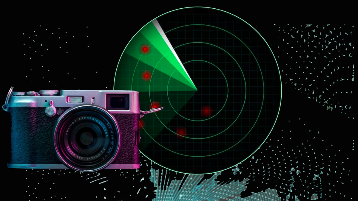
LiDAR Based People Counting Technologies
A key element of enhancing efficiency and reducing costs in Smart Spaces is the integration of People Counting Technologies.
These shortcomings underscore the need for more advanced, privacy-conscious solutions in data collection and analysis.
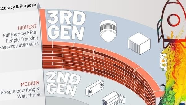
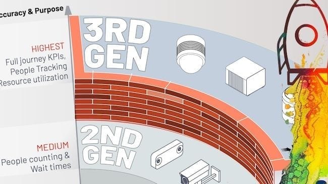
LiDAR-based Spatial Intelligence is the third-generation of People Flow Monitoring technology which address the need of the hour and can provide full user journey KPIs even in the case of multi-level and a mix of indoor-outdoor settings.
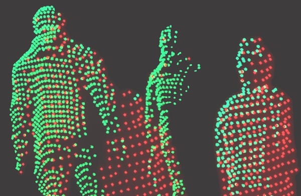
With the help of Outsight's Computer Vision software, it is now possible to digitize the displacements and interactions of people captured by LiDAR sensors within any infrastructure in real-time to derive valuable insights.
The Benefits of People Counting Across Multiple Sectors
- Retail Outlets
Understanding the movement patterns of customers in retail outlets has numerous benefits. By analyzing real-time 3D LiDAR data on how customers navigate the store, retailers can identify high-traffic areas and strategically place promotions and popular items to maximize visibility and sales.

LiDAR based Spatial Intelligence is being used in food retail
LiDAR data on customer counts, when used with an advanced analytics software can trigger alerts to open additional checkout counters, reducing wait times and enhancing customer satisfaction.
Outsight's people counting solution can analyze foot traffic and dwell times which are key elements of in-store customer behaviour.
This valuable data provides insights into the most frequented as well as under utilised areas, helping businesses optimise store layouts & ensure cost-effectiveness leading to a better return on investment.

- Office Spaces
In modern office environments, understanding the flow and occupancy of spaces is crucial for optimizing workspace utilization and enhancing employee experience.
This data can help in preventing overcrowding and ensuring that office spaces are utilized optimally, which can reduce the need for additional office space and associated costs.

LiDAR data-driven insights into space utilization can also help in optimizing cleaning schedules, Heating Ventilation & Air Conditioning (HVAC) systems, as well as lighting.
For instance, areas that are frequently used can be prioritized for cleaning, improving efficiency. While lighting and HVAC systems can be adjusted based on real-time occupancy, leading to significant energy savings and improved environmental sustainability.
- Large Venues
Real-time tracking of crowd density helps in preventing overcrowding and ensuring the safety of attendees at large venues like stadiums, concert halls, and exhibition centres. This is crucial input for managing large events where overcrowding can lead to safety hazards.
Owing to Outsight's Spatial AI, large venues can access detailed insights into how people enter and exit the venue assist in designing more efficient pathways, reducing congestion.

This not only improves the attendee experience but also enhances security by ensuring smoother and more controlled entry and exit points.
Data on visitor movement and behaviour can be used to improve services such as food and beverage distribution, restrooms, and other amenities.
For example, by understanding peak times for concession stands, venue operators can ensure they are adequately staffed to handle high demand.

- Public Spaces
In public spaces like parks, plazas, and streets, LiDAR technology enhances urban management.
Continuous monitoring of public areas helps in identifying and responding to potential safety hazards or security threats. This includes detecting unusual patterns of movement that might indicate a security concern and allowing for timely interventions.

Real-time 3D Spatial data aids in managing large public events by optimizing crowd control measures and ensuring smooth operations. This is especially important for outdoor festivals, parades, and other events.

Planners can use this data to design spaces that encourage positive social interactions and better serve the community's needs.
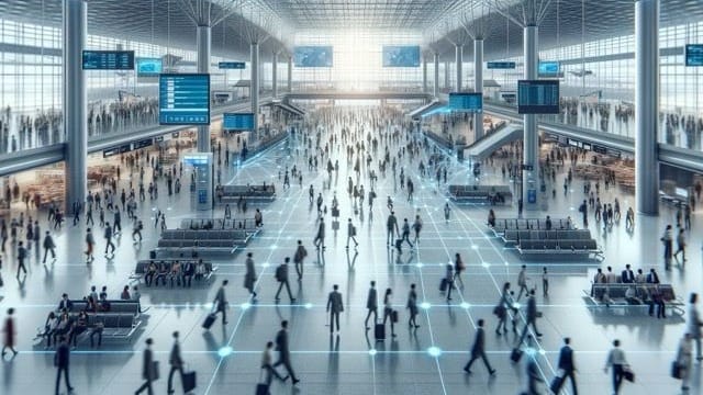
- Transportation Hubs
Real-time and anonymous tracking of passenger movement with LiDAR technology helps in managing queues, reducing wait times, and improving overall efficiency.
This leads to a smoother travel experience and can help transportation hubs like airports and railway stations in handling peak times more effectively.
Detailed Spatial Intelligence insights aid in monitoring and managing security checkpoints more effectively. By understanding passenger flow, security personnel can be better positioned to handle potential issues and ensure safety.

Real time 3D analytics on passenger flow and behaviour supports better resource allocation and improves the overall passenger experience. For instance, knowing peak times for different key areas can help allocate staff more efficiently, reducing bottlenecks and improving service levels.
Conclusion
People counting technologies, particularly those leveraging 3D LiDAR, are the new norm for the way Smart Spaces are managed and optimized.
Outsight’s Shift LiDAR Software stands at the forefront of this ongoing shift to the new norm, offering unparalleled spatial intelligence across a wide range of indoor and outdoor environments.
By delivering detailed insights while maintaining privacy and reducing infrastructure costs, Outsight is facilitating the shift to smarter, safer, and more efficient environments around the globe.