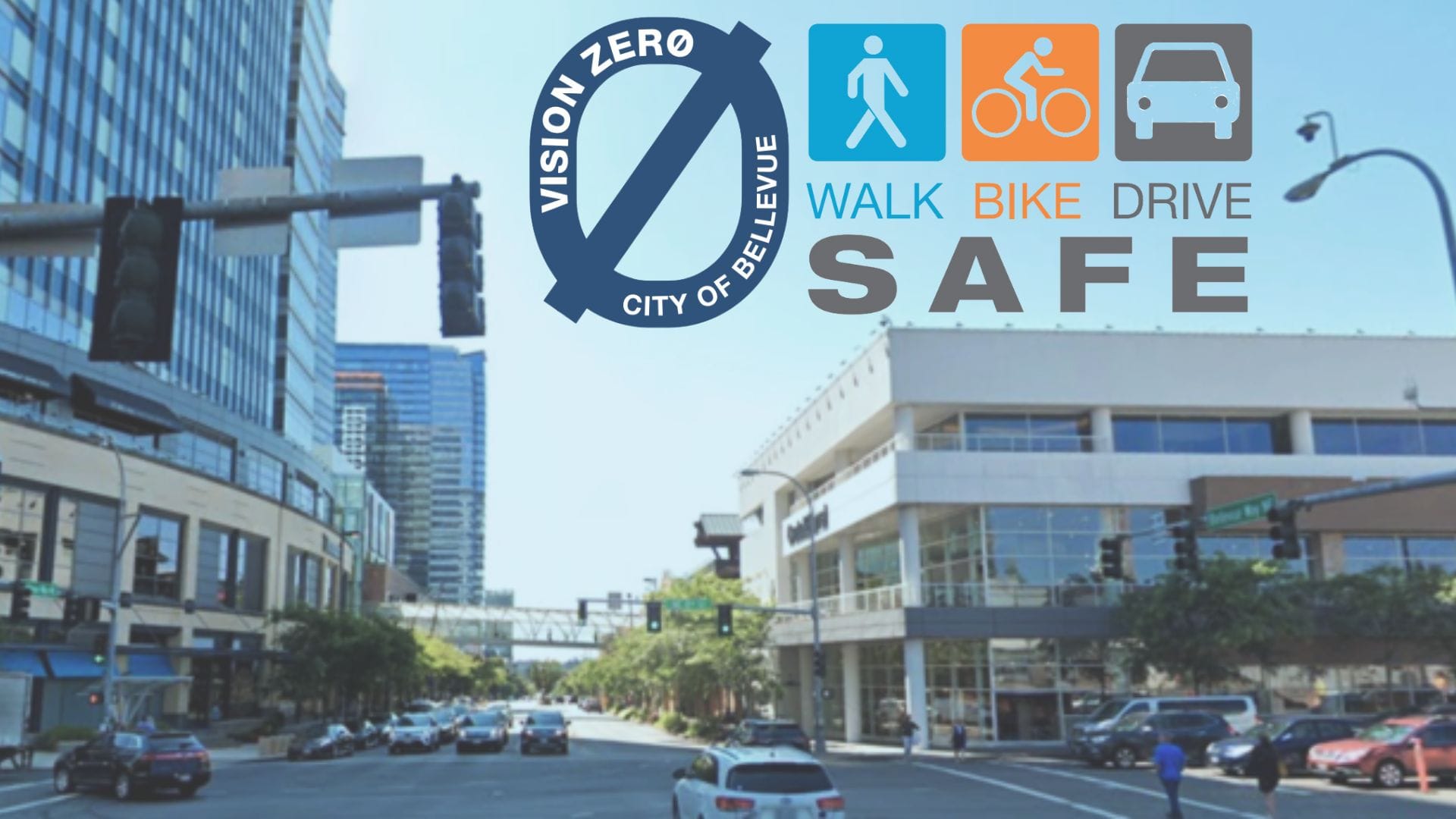
Enhancing Intersection Safety: Bellevue's Vision Zero Initiative with Outsight's Technology
LiDAR technology is transforming pedestrian safety and setting benchmarks for Smart City Solutions. Discover how Bellevue, under its Vision Zero initiative, is leveraging Spatial AI to make the city a safer place for its citizens

The City of Bellevue, in the state of Washington in the USA, has been a front-runner in adopting cutting-edge technology for enhancing public safety and traffic management.
Committed to the Vision Zero initiative, which aims to eliminate traffic deaths and serious injuries by 2030.
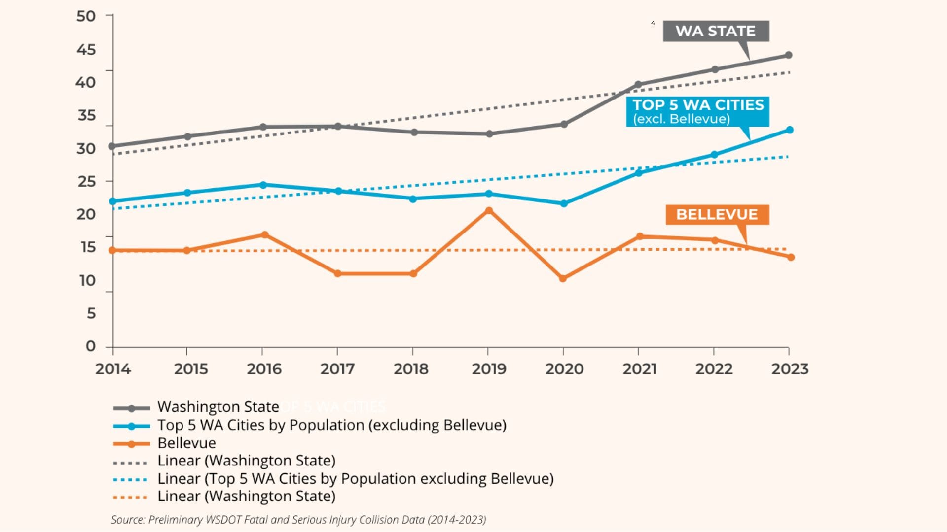
An analysis of crash data from 2017 to 2021 reveals that 72% of pedestrian-related fatalities and severe injuries occurred at intersections in the City of Bellevue, Washington. Hence, the city's council strategically focuses on intersections to implement high performing technology.
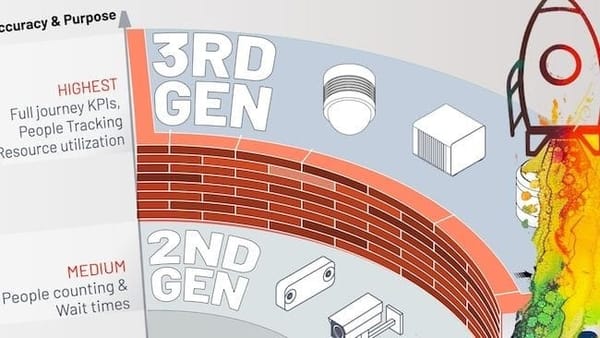
Since 2021, the city's council has been leveraging Outsight’s 3D LiDAR data insights to enhance road safety for vulnerable road users (VRU).
This partnership is pivotal in transforming Bellevue into a smarter and safer city by leveraging advanced traffic control systems and situation awareness technologies.
The new project, the Passive Pedestrian Detection Phase Extension, involves a sophisticated application of adaptive signal control tailored for pedestrian safety, utilizing LiDAR sensors alongside Outsight’s Spatial AI.
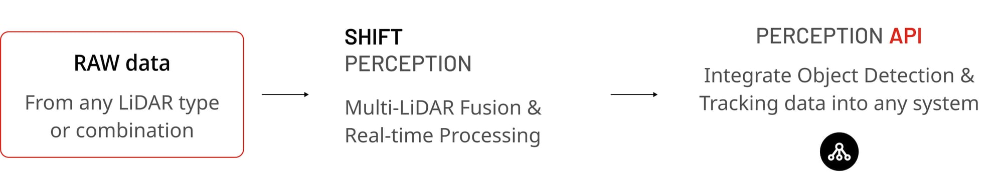
This pilot integrates Outsight’s 3D Perception Software with additional technologies from partners like Ouster, Amazon Web Services and Blue-Band.
These technologies work together to interpret complex traffic data in real-time, ensuring dynamic and efficient traffic management.
Specifically, this project assesses how LiDAR sensors at critical intersections can detect pedestrians and communicate with traffic control systems to adapt signal timings in real-time, enhancing pedestrian safety and optimizing traffic flow.
How did Bellevue implement this ?
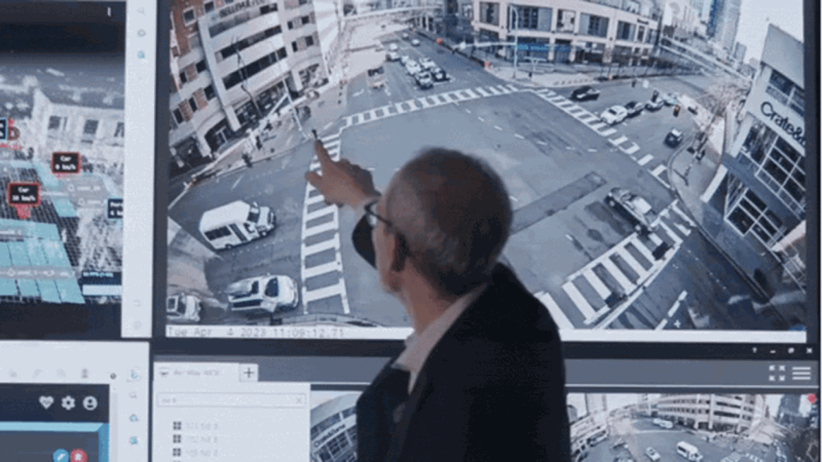
Two Ouster LiDAR sensors were installed at the intersection of Bellevue Way and NE 8th Street: one on the northwest corner signal pole and one on the southeast corner pole.
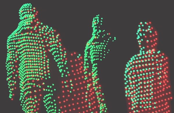
The millions of points of raw data from these sensors were processed in real time by Outsight's 3D Perception Software.
Bellevue's project team customised their Zones of Interest owing to Outsight's Shift Analytics solution.
Different zones were set up for pedestrians and vehicles. The pedestrian zones were drawn to be the width of the crosswalk and within a few feet of the curb.
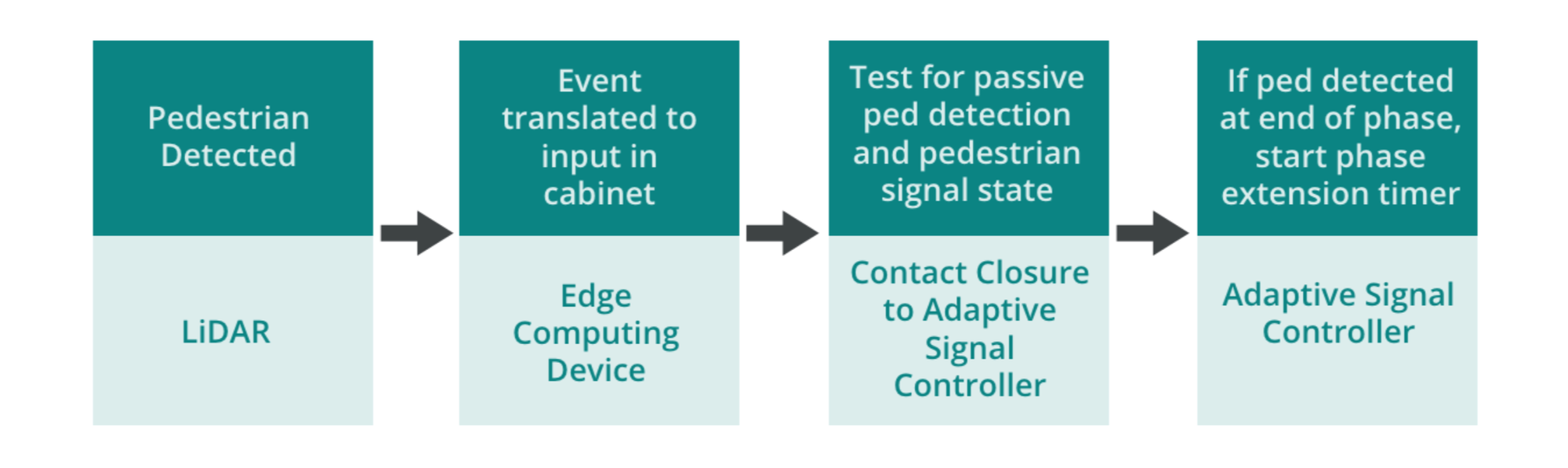
Every time a "pedestrian detected" event was captured by Outsight's 3D Computer Vision Software, it was translated to the traffic signal controller using the Integrator-AI platform by Blue-Band for an adaptive signal system used in the city.
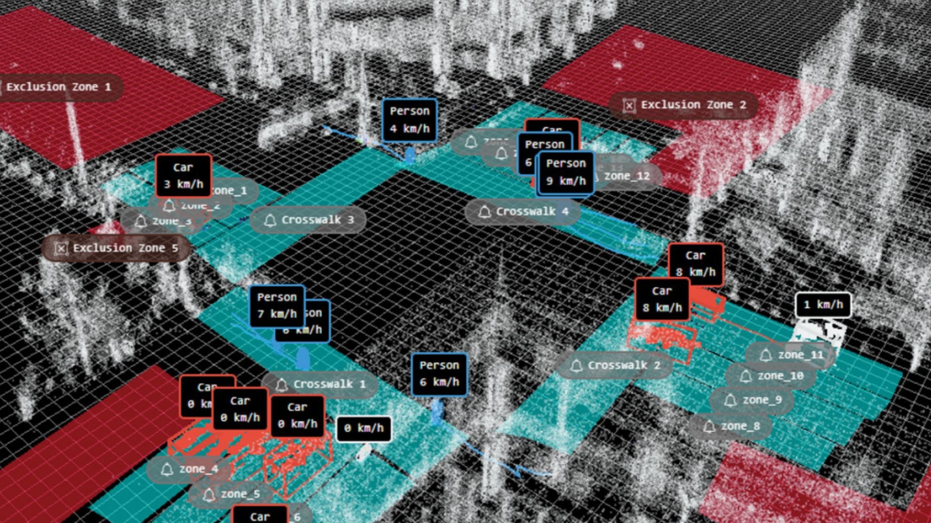
In the case of a pedestrian detected on the crosswalk just before the signal would turn yellow, it would add more time and the signal would remain green for a longer walk time, enabling the pedestrian to cross the road safely and avoid a collision.
The Results
The results highlighted the effectiveness and precision of the system in enhancing pedestrian safety. Below is a summary of the key findings from the evaluation:
- Reduction in Vehicle-Pedestrian Conflicts: Utilizing Outsight's Shift LiDAR Software led to a notable decrease in vehicle-pedestrian conflicts, enhancing the results achieved from the Leading Pedestrian Intervals pilot conducted in 2019
- Enhanced Real-Time Response: The technology's real-time data processing enabled immediate adjustments to traffic signal phases, which effectively responded to dynamic road conditions and pedestrian movements.
- Accurate Metrics: The system consistently achieved high detection precision (70-97%) across various crosswalks and timeframes, accurately identifying pedestrians within the crosswalk zones with a minimal miss rate of less than 10%.
- Impact on Traffic Flow: Analysis revealed a decrease in the percentage of time traffic was over-saturated (above 120% DS) with the phase extension in January 2024 compared to December 2023, suggesting minimal impact on traffic congestion due to the phase extensions.
- Reinforces the Integration of LiDAR with other technologies: The evaluation reinforces the endless capabilities for integrating LiDAR data with other cutting-edge technologies like video analytics and advanced mobility analytics platforms, promising enhancements to urban traffic management systems.
Conclusion
In conclusion, Bellevue’s deployment of Outsight’s Shift LiDAR Software sets a new standard for intelligent traffic control systems worldwide.
This initiative not only enhances pedestrian safety but also showcases the scalability of AI in public safety applications, positioning Bellevue as a benchmark for smart city solutions.
Learn more about how Outsight’s world-leading Spatial AI Software is driving advancements in Intelligent Transportation Systems.