LiDAR monitoring for Safer and Smarter Parking Lots
With its unrivaled precision and its ability to work under any lighting and weather condition, LiDAR is a great asset for Parking Monitoring challenges.
With an ever-growing number of vehicles on our roads, Parking Management is becoming an unavoidable challenge for the Smart City market.
However, traditional monitoring technologies fall short in delivering real-time actionable insights for Operators, specially in challenging lighting and weather conditions.
LiDAR technology and its software offer a cost-effective, performing solution to tackle these challenges. In the forthcoming year, its implementation will be crucial to unlock the full potential of Parking Monitoring Systems.
But to get the most out of LiDAR technology, you must understand how it works and the advantages of employing it.
How does LiDAR work?
Originally developed for the Automotive Industry, LiDAR is a technology that uses laser beams to measure distances with an unprecedented level of accuracy.
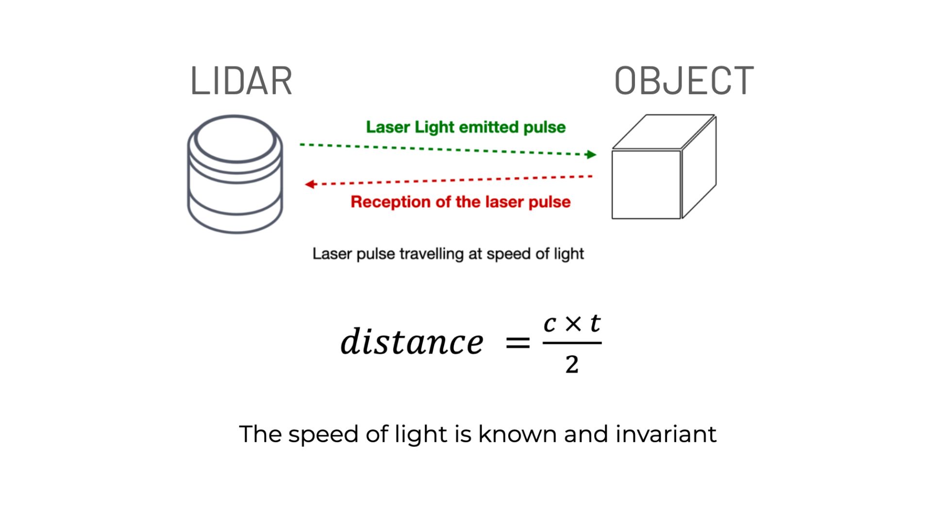
You can find more information in our article explaining these principles:

This LiDAR-generated spatial data is called "3D Point Cloud", but cannot be used on its own. A LiDAR Processing software is needed to turn these raw data into 3D information.
That's our mission at Outsight: to develop software solutions that allow Operators to access real-time actionable data from any LiDAR to help them manage their infrastructures.

Why LiDAR for Parking Monitoring ?
With proper processing software, LiDAR can analyse people and vehicle flow throughout complex environments in real-time.
On one hand, this provides users with instant updates on the availability of parking spaces and traffic condition : they can effortlessly find vacant spots and avoid congestion while navigating a Parking Lot.
Unlike traditional monitoring technologies that are vulnerable to rain, fog, or low-light environments, LiDAR excels in adverse conditions.
Moreover, a small number of sensors is enough to analyze large areas.

Where to start ?
Every parking facility has its unique requirements and configurations ranging from compact car spaces to very large truck zones and multi-level parking structures.
Depending on the size of the area that needs coverage, or the type and number of objects your want to track, some LiDAR sensors are more suitable than others.
And what better way to choose from all of the manufacturers than our Multi-vendor LiDAR simulator ?
Discover our simulator right here :
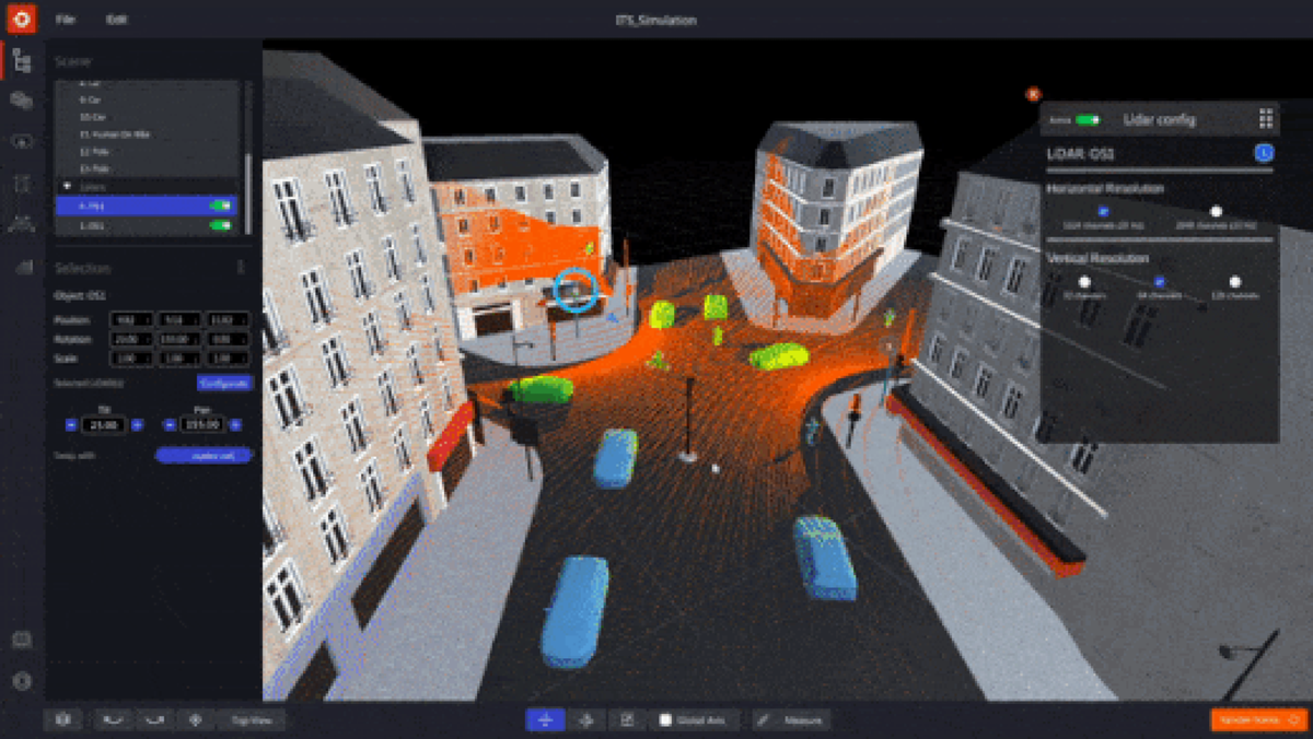
Our Plug & Play solution then centralizes the data from any sensor under a single customizable interface with specifics KPI.

We give Operators all the tools they need to increase not only Users' safety and experience, but Infrastructure security and operational efficiency as well.
Conclusion
LiDAR-based parking occupancy monitoring is revolutionizing the way Parking Lots are managed and utilized.
To optimize the deployment of relevant LiDAR installations, we have assembled the most experienced team of LiDAR specialists.
We support our customers at every stage of their projects by providing them with the most advanced solutions on the market.
Download our newest whitepaper or talk with a Product Specialist to get your LiDAR solution ready!


