LiDAR Solutions for the Shipping Industry
LiDAR applications like port crane safety automation and maritime navigation are changing the shipping industry as a whole, everywhere in the world.
When it comes to the incorporation of cutting-edge technologies like autonomous shipping, the shipping sector is up against increasingly challenging difficulties.
The need for higher safety, decreased costs, and improved utilization of human resources is the primary factor driving this change in the maritime industry.
Modern day stresses on the crew and port operators include increased economic pressure, port congestion times, and vessel size, which heighten risks and cause losses as a result of bad decisions.
Indeed, the AGCS analysis shows that 75% of shipping incidents involve some type of human error (1).
It is necessary to adapt and apply cutting-edge developments in maritime technology as soon and easily as feasible in order to meet these expectations.
LiDAR data is particularly well suited to addressing these issues due to its native 3D Spatial Perception.
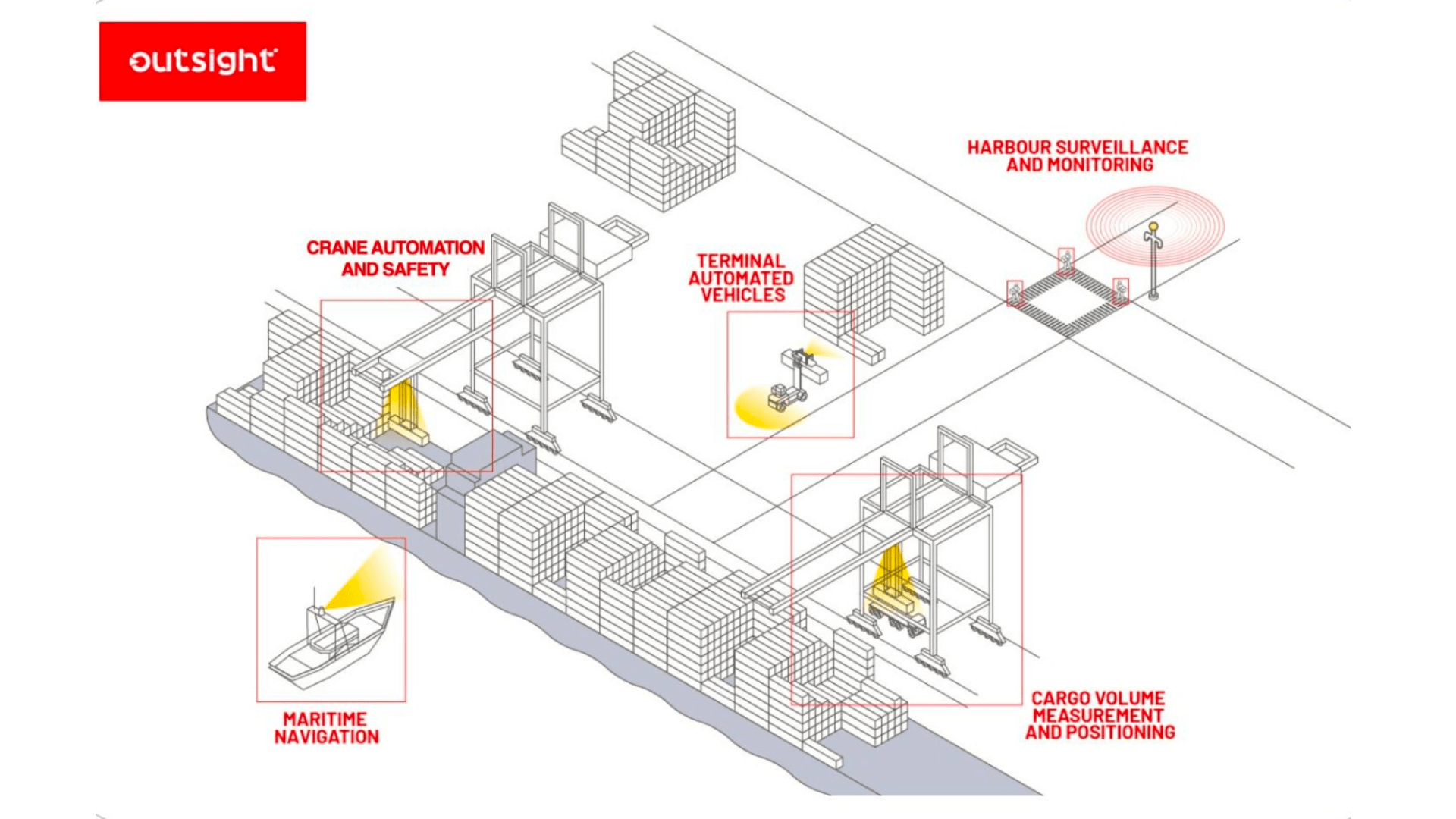
This new kind of 3D Sensor has a wide range of possible uses in the maritime industry, including port surveillance and monitoring, maritime navigation, terminal automated vehicles, crane safety and automation, and many more!
Get onboard to discover how LiDAR applications are now changing the maritime context!
Harbour surveillance and monitoring
LiDAR technology is taking the place of cameras to monitor the yard and provide real-time data on containers and port equipment.
The main reasons are that LiDAR covers noticeably greater ranges (up to 300m), generates increased object detection precision during day and night, and respects privacy.
As a result, ports can use fewer sensors to provide complete coverage.
There are two possible set-ups to do that, and they can be combined:
- By using static LiDAR sensors, which collect LiDAR point clouds from a static location, this would be an infrastructure-based setup.
- By using moving LiDAR sensors, which collect LiDAR point clouds from a moving platform and interpret them using Lidar SLAM algorithms, the vehicle-based setup.
In the first case, LiDAR allows port operations to quickly set and monitor customisable 3D digital barriers and produce real-time 3D maps, guaranteeing perimeter security.
It can also identify and track intruders across an entire sensitive site—and not only on perimeter fences like typical security systems—by fusing multiple LiDAR sensors strategically positioned within the site.

Beyond the security use cases, accurate premises-wide People and Vehicles flow monitoring is made possible, opening up a variety of new opportunities for increased operational excellence.
As an illustration of the second scenario, consider how the examination of elements through localization and perception, enabled by the Outsight LiDAR SLAM feature, ensures harbor security.
See how Outsight used our advanced 6DoF SLAM algorithms to survey and observe ships at port.
It’s worth mentioning that the latest LiDAR sensors can also endure the sea’s tough environment, which includes weather extremes like high heat or cold, snow and fog, as well as vibrations and dust.
Thanks to that, one interesting application of LiDAR is the autonomous offshore turbine inspection solution, including in low visibility or even complete darkness.
Port Crane Safety and Automation
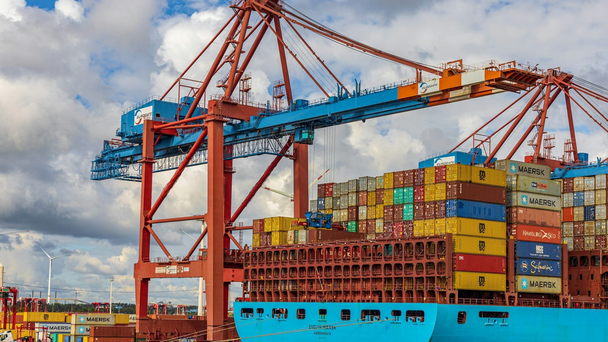
LiDAR sensors can be attached to an automatic stacking crane (ASC) or ship-to-shore (STS) crane—for example, like the one in the next image—to enable automated soft loading and unloading of containers and collision prevention.
With the use of LiDAR, equipment may be stopped before an accident happens by detecting items in warning and stop zones and determining the direction of cross traffic, but also to enable full automated operation.

The LiDAR sensor can also measure the container volume in order to maximise space use while picking up and stacking the units on the vessel or at the port.
As an example, one of Outsight’s clients used our Augmented LiDAR Box to measure cargo volume:
Additionally, LiDAR sensors can be placed on rubber-tired gantry cranes (RTGs)—as the one shown in the next picture, for instance—to provide automated navigation within the port area and to optimise truck positioning in relation to the crane.

Maritime Navigation
One of the most common LiDAR applications in the maritime industry is navigation assistance technology.
Smaller vessels can already rely on autonomous navigation to complete nearshore hydrographic survey data missions.
The next video shows how Outsight used its Advanced SLAM algorithms to survey and observe ships at port.
For larger vessels, the 3D vision of sailing ships can be reconstructed using high fusion information from LiDAR data to perceive the surrounding ships, identify the position of the ship itself and other nearby ships, and measure the distance between the nearby ships, allowing them to safely pass bridges.
At sea, LIDAR systems are high-quality remote sensing systems that can monitor environmental parameters, thus improving the accuracy of weather forecasting and cruise route calculations, thereby reducing cruise risk.
Terminal automated vehicles
The marine sector makes considerable use of automated guided vehicles (AGVs) and automated inter-terminal vehicles (AITVs), which are one of the most cutting-edge elements of a fully automated port.
By replacing yard tractors and removing the requirement for people to operate the tractors, AGVs and AITVs are establishing a quick, affordable, and secure container transit system within the port.
In the next image, you can see an automated AITV, powered by Velodyne LiDAR sensors and Outsight software:

Between the quayside and the container yard, containers are transported horizontally using AGVs and AITVs, which are fully automated, unmanned container transport vehicles.
DG World, one of Outsight’s clients, designed an Autonomous Intelligent Truck (TruGo) and an Autonomy Conversion Kit Solution (E-TruGo) that fit existing trucks, enabling 100% autonomy and flexibility.
Watch this other example of a self-driving truck, powered by Outsight and Ouster LiDAR, at Dubai’s Port:
Among other features, the Autonomy conversion kit offers remote control of all relevant truck functions; localization and mapping of sensor systems; perception and safety systems; and full driving autonomy.
Conclusion
These are just a few of the possible applications of LiDAR in the maritime context.
From supply chain management to vessel monitoring and navigation examples, we saw that the potential applications of LiDAR in maritime contexts involve many different industry segments and use cases.
LiDAR's characteristics make it a perfect fit for the shipping industry: LiDAR is a non-contact, remote sensing, 3D laser technology that can gather data at any time of day or in any weather, making it a secure and trustworthy monitoring tool.
Our mission at Outsight is to build the easiest and most efficient way to use 3D LiDAR data in any application.
With the use of our real-time preprocessing software, it has never been simpler to develop advanced 3D-based solutions for the maritime industry.
Download our free Whitepaper to learn more by clicking below:
(1) Source: 14,828 liability insurance claims analysed between 2011 and 2016. Global Claims Review: Liability In Focus. Allianz Global Corporate and Specialty.


